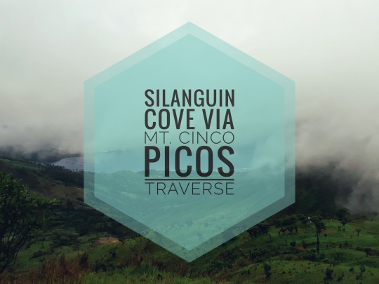
It feels good to be able to write an entry again. This time it is about our most recent adventure; Way to Silanguin Cove via Mt. Cinco Picos Traverse.
Mate
before I start, let’s gen up a bit. Here’s a little information about Mt. Cinco Picos taken from Pinoy Mountaineer page
MT. CINCO PICOS
Subic, Zambales
Major jump-off: Sitio Cawag Settment, Subic
LLA: 14° 47′ N 120° 9′ E, 881 MASL
Days required / Hours to summit: 2 days / 6-7 hours
Specs: Major climb, Difficulty 3/9, Trail class 3
BACKGROUND
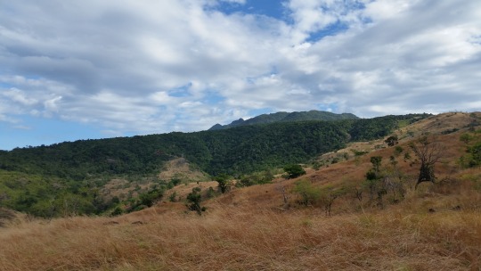
Mt. Cinco Picos in Subic, Zambales is a hiking destination
that is attracting the interest of more and more climbers. Once a training
ground for US servicemen stationed in the now-defunct Subic Naval Base, this
mountain, like the nearby highlands, is home to the local Aetas who call the
mountain “Tatlong Tirad”. The Spanish name ‘Cinco Picos’ represents the five
peaks of the mountain. –Pinoy Mountaineer
The Plan vs. The Weather
We went last June 11 and 12. We’ve been planning on this for a month, to have a night stay at Silanguin Cove and since the Independence Day (12th day of June) falls on Monday, considering our day off from work (Sunday), it was indeed the perfect time so we marked the calendar and started preparing. We are a group of 11 pax divided into two teams, the team Bangka (composed of 4 pax) who bravely tamed the waves, and the strong-willed team Bundok (composed of 7 pax). Both teams decided to push through despite
 |
| Image source: www.panahon.tv |
At
first it feels so daunting; can we really make it amidst the forming storm? I
am worried, especially for team Bangka. They will be sailing for one or more
hours into the open sea. I don’t want to think about the worst case scenario, but I
can’t help it. But we, the team Bundok still decided to go.
The Ascend
At
2AM on June 11, we, the team Bundok, was already on our feet at Cawag Settment
(Jump-off) when suddenly it rained hard. All went crazy looking for raincoats.
But wait, I don’t have one. Despite the preparation and the effort of my
friends to remind me since we expect a moody weather, still, I failed to bring one.
So that leaves me no choice but make do with what we have and make it work. I
used garbage bags instead. The idea was brilliant but they were teasing me the
whole time. (Savage right??). Moving on, we really had a hard time. The trail
was slippery and muddy that our feet were sinking up to the ankle. Good thing
this time we brought flashlights because the surrounding was still pitch-black.
We can also see the lights of other hikers from neighboring mountains (Mt.
Balingkilat and Mt. Bira-bira) We’ve gone to many ups-and-downs yet our guide
says we are still far and the first peak was nowhere in sight, it felt like
we’ve traversed two mountains already. Cheesed off, it really felt like
forever. Due to the bad weather, we had little stop overs and rests on our way
to the first peak, it helped on quenching our thirst. Imagine I am able to
reach the site overlooking the Hanjin Heavy Industries and Construction
Philippines without a single sip from my packed water. We stayed on that site a
bit for some snacks and photo ops.


The Summit (First Peak)
As
we continued our way to the first peak, the trail was becoming rocky, and from
there we have already been greeted by the mist, kissing our cheeks and
moisturizing our skin. Numerous rock formations can be seen which reminds me so
much of Mt. Maculot Rockies, but it’s the mini and scattered version. Like our
hike to Mt. Maculot, we had little chances of clearing to gasp the
breathtakingly blinding view. There’s an element of surprise, like a theatre
with curtains waiting for the show to commence. We stayed for almost an hour
for cell phone signal because we need to contact and verify if the team Bangka
could sail and if ever they were not allowed, they will try the next day. If
the weather doesn’t get better till the next day, we have no choice but to
traverse back to Sitio Cawag.


During
our stay on the first peak, we had fun taking pictures and videos. We managed
to film a short Mannequin Challenge when suddenly, the warm, fun time we had turned
into a cold terrifying experience. The rain started again with the wind blowing
hard. We thought that it wouldn’t last like our earlier experience, but we were
wrong. We secured our backpacks using garbage bags. Raincoats are no matched,
we are all soaked. Our bodies were shaking with cold. We decided not to pursue
the second peak even if it will only take just 15 minutes to get there. The
second peak was higher and we witnessed from afar that it was covered with fog.
We are petrified for what could happen. We sat still while waiting for team
Bangka’s reply, and when the rain dwindled, we took that opportunity to descend
towards Silanguin Cove.

To Silanguin Cove
On
our way, we met a group of hikers from Manila who stayed for a night at a
camping spot just along the trail. They are already gearing up when we asked
them if they will also proceed to Silanguin Cove, but they were still undecided
and were also weighing the chances if the weather will soon be better. It was a
long rocky descending trail. The way to Silanguin Cove was full of river
crossing. I wasn’t able to keep track of the number of rivers we crossed so I
cannot declare an exact digit.

We
reached Silanguin Cove and everything was hunky-dory except of course that we
do not know if team Bangka sailed and of that moment we don’t have ways to
communicate to them as cell phone signals are no longer available. We are
absolutely knackered after walking like forever, so we took our rest while
worrying for the next thing to do.

Stay
tuned to know how team Bangka made it...


0 Comments